


Location:
Southeastern Africa, bordering the Mozambique Channel, between South Africa and Tanzania
Geographic coordinates:
18 15 S, 35 00 E
Map references:
Africa
Area:
total: 799,380 sq km
[see also: Area - total country ranks ]
land: 786,380 sq km
[see also: Area - land country ranks ]
water: 13,000 sq km
[see also: Area - water country ranks ]
country comparison to the world (CIA rank, may be based on non-current data):
36
Area - comparative:
slightly more than five times the size of Georgia; slightly less than twice the size of California
Area comparison map:
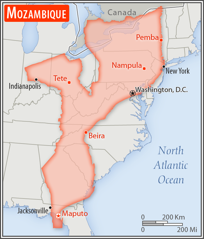
slightly more than five times the size of Georgia; slightly less than twice the size of California
Land boundaries:
total: 4,783 km
[see also: Land boundaries - total country ranks ]
border countries (6):
Malawi 1498 km, South Africa 496 km, Eswatini 108 km, Tanzania 840 km, Zambia 439 km, Zimbabwe 1402 km
Coastline:
2,470 km
[see also: Coastline country ranks ]
Maritime claims:
territorial sea: 12
nm
[see also: Maritime claims - territorial sea country ranks ]
exclusive economic zone: 200
nm
[see also: Maritime claims - exclusive economic zone country ranks ]
Climate:
tropical to subtropical
More Climate Details
Terrain:
mostly coastal lowlands, uplands in center, high plateaus in northwest, mountains in west
Elevation:
mean elevation: 345 m
[see also: Elevation - mean elevation country ranks ]
lowest point:
Indian Ocean 0 m
highest point:
Monte Binga 2,436 m
Natural resources:
coal, titanium, natural gas, hydropower, tantalum, graphite
Land use:
agricultural land: 56.3%
(2011 est.)
[see also: Land use - agricultural land country ranks ]
arable land: 6.4%
(2011 est.)
[see also: Land use - arable land country ranks ]
permanent crops: 0.3%
(2011 est.)
[see also: Land use - permanent crops country ranks ]
permanent pasture: 49.6%
(2011 est.)
[see also: Land use - permanent pasture country ranks ]
forest: 43.7%
(2011 est.)
[see also: Land use - forest country ranks ]
other: 0%
(2011 est.)
[see also: Land use country ranks ]
Irrigated land:
1,180 sq km
(2012)
[see also: Irrigated land country ranks ]
Population distribution:
three large populations clusters are found along the southern coast between Maputo and Inhambane, in the central area between Beira and Chimoio along the Zambezi River, and in and around the northern cities of Nampula, Cidade de Nacala, and Pemba; the northwest and southwest are the least populated areas
Natural hazards:
severe droughts; devastating cyclones and floods in central and southern provinces
Environment - current issues:
increased migration of the population to urban and coastal areas with adverse environmental consequences; desertification; soil erosion; deforestation; water pollution caused by artisanal mining; pollution of surface and coastal waters; wildlife preservation (elephant poaching for ivory)
Environment - international agreements:
party to:
Biodiversity, Climate Change, Climate Change-Kyoto Protocol, Desertification, Endangered Species, Hazardous Wastes, Law of the Sea, Ozone Layer Protection, Ship Pollution, Wetlands
signed, but not ratified:
none of the selected agreements
Geography - note:
the Zambezi River flows through the north-central and most fertile part of the country
NOTE: 1) The information regarding Mozambique on this page is re-published from the 2020 World Fact Book of the United States Central Intelligence Agency and other sources. No claims are made regarding the accuracy of Mozambique Geography 2020 information contained here. All suggestions for corrections of any errors about Mozambique Geography 2020 should be addressed to the CIA or the source cited on each page.
2) The rank that you see is the CIA reported rank, which may have the following issues:
a) They assign increasing rank number, alphabetically for countries with the same value of the ranked item, whereas we assign them the same rank.
b) The CIA sometimes assigns counterintuitive ranks. For example, it assigns unemployment rates in increasing order, whereas we rank them in decreasing order.
- Main Index
- 2020 Index
- Country Ranks
- Definitions
- Mozambique Index 2020
- Mozambique Main Index
- Introduction
- History
- Geography
- Climate
- Maps
- People
- Religion
- Government
- Gov. Leaders
- Flags
- Economy
- Energy
- Communications
- Transportation
- Airport Codes
- Military
- Transnational Issues
- Photos
- Advertise Here
- Feedback

This page was last modified 27-Jan-20