


Location:
Southwestern Europe, bordering the Mediterranean Sea, North Atlantic Ocean, Bay of Biscay, and Pyrenees Mountains; southwest of France
Geographic coordinates:
40 00 N, 4 00 W
Map references:
Europe
Area:
total: 505,370 sq km
[see also: Area - total country ranks ]
land: 498,980 sq km
[see also: Area - land country ranks ]
water: 6,390 sq km
note: there are two autonomous cities - Ceuta and Melilla - and 17 autonomous communities including Balearic Islands and Canary Islands, and three small Spanish possessions off the coast of Morocco - Islas Chafarinas, Penon de Alhucemas, and Penon de Velez de la Gomera
country comparison to the world (CIA rank, may be based on non-current data):
53
Area - comparative:
almost five times the size of Kentucky; slightly more than twice the size of Oregon
Area comparison map:
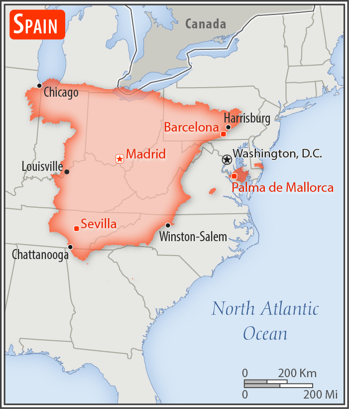
almost five times the size of Kentucky; slightly more than twice the size of Oregon
Land boundaries:
total: 1,952.7 km
[see also: Land boundaries - total country ranks ]
border countries (6):
Andorra 63 km, France 646 km, Gibraltar 1.2 km, Portugal 1224 km, Morocco (Ceuta) 8 km, Morocco (Melilla) 10.5 km
note: an additional 75-meter border segment exists between Morocco and the Spanish exclave of Penon de Velez de la Gomera
Coastline:
4,964 km
[see also: Coastline country ranks ]
Maritime claims:
territorial sea: 12
nm
[see also: Maritime claims - territorial sea country ranks ]
exclusive economic zone: 200
nm (applies only to the Atlantic Ocean)
[see also: Maritime claims - exclusive economic zone country ranks ]
contiguous zone: 24
nm
[see also: Maritime claims - contiguous zone country ranks ]
Climate:
temperate; clear, hot summers in interior, more moderate and cloudy along coast; cloudy, cold winters in interior, partly cloudy and cool along coast
More Climate Details
Terrain:
large, flat to dissected plateau surrounded by rugged hills; Pyrenees Mountains in north
Elevation:
mean elevation: 660 m
[see also: Elevation - mean elevation country ranks ]
lowest point:
Atlantic Ocean 0 m
highest point:
Pico de Teide (Tenerife) on Canary Islands 3,718 m
Natural resources:
coal, lignite, iron ore, copper, lead, zinc, uranium, tungsten, mercury, pyrites, magnesite, fluorspar, gypsum, sepiolite, kaolin, potash, hydropower, arable land
Land use:
agricultural land: 54.1%
(2011 est.)
[see also: Land use - agricultural land country ranks ]
arable land: 24.9%
(2011 est.)
[see also: Land use - arable land country ranks ]
permanent crops: 9.1%
(2011 est.)
[see also: Land use - permanent crops country ranks ]
permanent pasture: 20.1%
(2011 est.)
[see also: Land use - permanent pasture country ranks ]
forest: 36.8%
(2011 est.)
[see also: Land use - forest country ranks ]
other: 9.1%
(2011 est.)
[see also: Land use country ranks ]
Irrigated land:
38,000 sq km
(2012)
[see also: Irrigated land country ranks ]
Population distribution:
with the notable exception of Madrid, Sevilla, and Zaragoza, the largest urban agglomerations are found along the Mediterranean and Atlantic coasts; numerous smaller cities are spread throughout the interior reflecting Spain's agrarian heritage; very dense settlement around the capital of Madrid, as well as the port city of Barcelona
Natural hazards:
periodic droughts, occasional flooding
volcanism: volcanic activity in the Canary Islands, located off Africa's northwest coast; Teide (3,715 m) has been deemed a Decade Volcano by the International Association of Volcanology and Chemistry of the Earth's Interior, worthy of study due to its explosive history and close proximity to human populations; La Palma (2,426 m), which last erupted in 1971, is the most active of the Canary Islands volcanoes; Lanzarote is the only other historically active volcano
Environment - current issues:
pollution of the Mediterranean Sea from raw sewage and effluents from the offshore production of oil and gas; water quality and quantity nationwide; air pollution; deforestation; desertification
Environment - international agreements:
party to:
Air Pollution, Air Pollution-Nitrogen Oxides, Air Pollution-Sulfur 94, Air Pollution-Volatile Organic Compounds, Antarctic-Environmental Protocol, Antarctic-Marine Living Resources, Antarctic Treaty, Biodiversity, Climate Change, Climate Change-Kyoto Protocol, Desertification, Endangered Species, Environmental Modification, Hazardous Wastes, Law of the Sea, Marine Dumping, Marine Life Conservation, Ozone Layer Protection, Ship Pollution, Tropical Timber 83, Tropical Timber 94, Wetlands, Whaling
signed, but not ratified:
Air Pollution-Persistent Organic Pollutants
Geography - note:
strategic location along approaches to Strait of Gibraltar; Spain controls a number of territories in northern Morocco including the enclaves of Ceuta and Melilla, and the islands of Penon de Velez de la Gomera, Penon de Alhucemas, and Islas Chafarinas
NOTE: 1) The information regarding Spain on this page is re-published from the 2020 World Fact Book of the United States Central Intelligence Agency and other sources. No claims are made regarding the accuracy of Spain Geography 2020 information contained here. All suggestions for corrections of any errors about Spain Geography 2020 should be addressed to the CIA or the source cited on each page.
2) The rank that you see is the CIA reported rank, which may have the following issues:
a) They assign increasing rank number, alphabetically for countries with the same value of the ranked item, whereas we assign them the same rank.
b) The CIA sometimes assigns counterintuitive ranks. For example, it assigns unemployment rates in increasing order, whereas we rank them in decreasing order.
- Main Index
- 2020 Index
- Country Ranks
- Definitions
- Spain Index 2020
- Spain Main Index
- Introduction
- History
- Geography
- Climate
- Maps
- People
- Religion
- Government
- Gov. Leaders
- Flags
- Economy
- Energy
- Communications
- Transportation
- Airport Codes
- Military
- Terrorism
- Transnational Issues
- Photos
- Advertise Here
- Feedback

This page was last modified 27-Jan-20