


Location:
Southern Africa, east of Angola, south of the Democratic Republic of the Congo
Geographic coordinates:
15 00 S, 30 00 E
Map references:
Africa
Area:
total: 752,618 sq km
[see also: Area - total country ranks ]
land: 743,398 sq km
[see also: Area - land country ranks ]
water: 9,220 sq km
[see also: Area - water country ranks ]
country comparison to the world (CIA rank, may be based on non-current data):
40
Area - comparative:
almost five times the size of Georgia; slightly larger than Texas
Area comparison map:
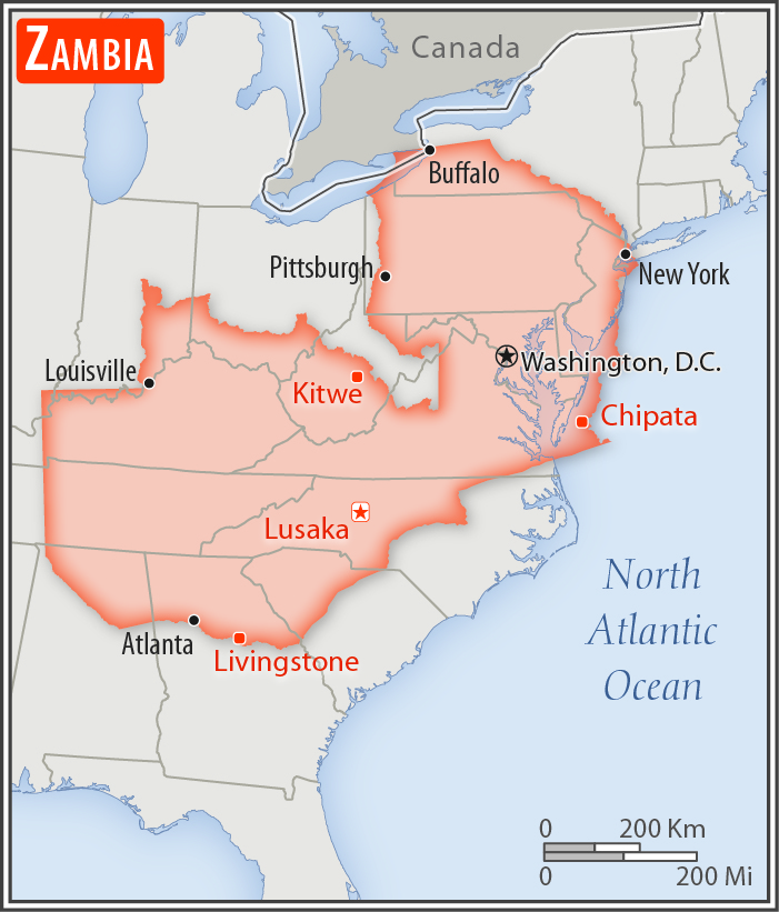
almost five times the size of Georgia; slightly larger than Texas
Land boundaries:
total: 6,043.15 km
[see also: Land boundaries - total country ranks ]
border countries (8):
Angola 1065 km, Botswana 0.15 km, Democratic Republic of the Congo 2332 km, Malawi 847 km, Mozambique 439 km, Namibia 244 km, Tanzania 353 km, Zimbabwe 763 km
Coastline:
0 km
(landlocked)
[see also: Coastline country ranks ]
Maritime claims:
none (landlocked)
Climate:
tropical; modified by altitude; rainy season (October to April)
Terrain:
mostly high plateau with some hills and mountains
Elevation:
mean elevation: 1,138 m
[see also: Elevation - mean elevation country ranks ]
lowest point:
Zambezi river 329 m
highest point:
unnamed elevation in Mafinga Hills 2,301 m
Natural resources:
copper, cobalt, zinc, lead, coal, emeralds, gold, silver, uranium, hydropower
Land use:
agricultural land: 31.7%
(2011 est.)
[see also: Land use - agricultural land country ranks ]
arable land: 4.8%
(2011 est.)
[see also: Land use - arable land country ranks ]
permanent crops: 0%
(2011 est.)
[see also: Land use - permanent crops country ranks ]
permanent pasture: 26.9%
(2011 est.)
[see also: Land use - permanent pasture country ranks ]
forest: 66.3%
(2011 est.)
[see also: Land use - forest country ranks ]
other: 2%
(2011 est.)
[see also: Land use country ranks ]
Irrigated land:
1,560 sq km
(2012)
[see also: Irrigated land country ranks ]
Population distribution:
one of the highest levels of urbanization in Africa; high density in the central area, particularly around the cities of Lusaka, Ndola, Kitwe, and Mufulira
Natural hazards:
periodic drought; tropical storms (November to April)
Environment - current issues:
air pollution and resulting acid rain in the mineral extraction and refining region; chemical runoff into watersheds; loss of biodiversity; poaching seriously threatens rhinoceros, elephant, antelope, and large cat populations; deforestation; soil erosion; desertification; lack of adequate water treatment presents human health risks
Environment - international agreements:
party to:
Biodiversity, Climate Change, Climate Change-Kyoto Protocol, Desertification, Endangered Species, Hazardous Wastes, Law of the Sea, Ozone Layer Protection, Wetlands
signed, but not ratified:
none of the selected agreements
Geography - note:
landlocked; the Zambezi forms a natural riverine boundary with Zimbabwe; Lake Kariba on the Zambia-Zimbabwe border forms the world's largest reservoir by volume (180 cu km; 43 cu mi)
NOTE: 1) The information regarding Zambia on this page is re-published from the 2020 World Fact Book of the United States Central Intelligence Agency and other sources. No claims are made regarding the accuracy of Zambia Geography 2020 information contained here. All suggestions for corrections of any errors about Zambia Geography 2020 should be addressed to the CIA or the source cited on each page.
2) The rank that you see is the CIA reported rank, which may have the following issues:
a) They assign increasing rank number, alphabetically for countries with the same value of the ranked item, whereas we assign them the same rank.
b) The CIA sometimes assigns counterintuitive ranks. For example, it assigns unemployment rates in increasing order, whereas we rank them in decreasing order.
- Main Index
- 2020 Index
- Country Ranks
- Definitions
- Zambia Index 2020
- Zambia Main Index
- Introduction
- History
- Geography
- Maps
- People
- Religion
- Government
- Gov. Leaders
- Flags
- Economy
- Energy
- Communications
- Transportation
- Airport Codes
- Military
- Transnational Issues
- Photos
- Advertise Here
- Feedback

This page was last modified 27-Jan-20