


Location:
Southern Africa, between South Africa and Zambia
Geographic coordinates:
20 00 S, 30 00 E
Map references:
Africa
Area:
total: 390,757 sq km
[see also: Area - total country ranks ]
land: 386,847 sq km
[see also: Area - land country ranks ]
water: 3,910 sq km
[see also: Area - water country ranks ]
country comparison to the world (CIA rank, may be based on non-current data):
62
Area - comparative:
about four times the size of Indiana; slightly larger than Montana
Area comparison map:
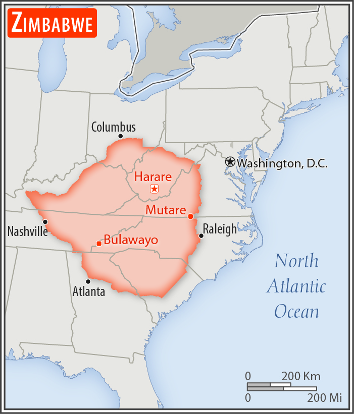
about four times the size of Indiana; slightly larger than Montana
Land boundaries:
total: 3,229 km
[see also: Land boundaries - total country ranks ]
border countries (4):
Botswana 834 km, Mozambique 1402 km, South Africa 230 km, Zambia 763 km
Coastline:
0 km
(landlocked)
[see also: Coastline country ranks ]
Maritime claims:
none (landlocked)
Climate:
tropical; moderated by altitude; rainy season (November to March)
Terrain:
mostly high plateau with higher central plateau (high veld); mountains in east
Elevation:
mean elevation: 961 m
[see also: Elevation - mean elevation country ranks ]
lowest point:
junction of the Runde and Save Rivers 162 m
highest point:
Inyangani 2,592 m
Natural resources:
coal, chromium ore, asbestos, gold, nickel, copper, iron ore, vanadium, lithium, tin, platinum group metals
Land use:
agricultural land: 42.5%
(2011 est.)
[see also: Land use - agricultural land country ranks ]
arable land: 10.9%
(2011 est.)
[see also: Land use - arable land country ranks ]
permanent crops: 0.3%
(2011 est.)
[see also: Land use - permanent crops country ranks ]
permanent pasture: 31.3%
(2011 est.)
[see also: Land use - permanent pasture country ranks ]
forest: 39.5%
(2011 est.)
[see also: Land use - forest country ranks ]
other: 18%
(2011 est.)
[see also: Land use country ranks ]
Irrigated land:
1,740 sq km
(2012)
[see also: Irrigated land country ranks ]
Population distribution:
Aside from major urban agglomerations in Harare and Bulawayo, population distribution is fairly even, with slightly greater overall numbers in the eastern half
Natural hazards:
recurring droughts; floods and severe storms are rare
Environment - current issues:
deforestation; soil erosion; land degradation; air and water pollution; the black rhinoceros herd - once the largest concentration of the species in the world - has been significantly reduced by poaching; poor mining practices have led to toxic waste and heavy metal pollution
Environment - international agreements:
party to:
Biodiversity, Climate Change, Desertification, Endangered Species, Hazardous Wastes, Law of the Sea, Ozone Layer Protection
signed, but not ratified:
none of the selected agreements
Geography - note:
landlocked; the Zambezi forms a natural riverine boundary with Zambia; in full flood (February-April) the massive Victoria Falls on the river forms the world's largest curtain of falling water; Lake Kariba on the Zambia-Zimbabwe border forms the world's largest reservoir by volume (180 cu km; 43 cu mi)
NOTE: 1) The information regarding Zimbabwe on this page is re-published from the 2020 World Fact Book of the United States Central Intelligence Agency and other sources. No claims are made regarding the accuracy of Zimbabwe Geography 2020 information contained here. All suggestions for corrections of any errors about Zimbabwe Geography 2020 should be addressed to the CIA or the source cited on each page.
2) The rank that you see is the CIA reported rank, which may have the following issues:
a) They assign increasing rank number, alphabetically for countries with the same value of the ranked item, whereas we assign them the same rank.
b) The CIA sometimes assigns counterintuitive ranks. For example, it assigns unemployment rates in increasing order, whereas we rank them in decreasing order.
- Main Index
- 2020 Index
- Country Ranks
- Definitions
- Zimbabwe Index 2020
- Zimbabwe Main Index
- Introduction
- History
- Geography
- Maps
- People
- Religion
- Government
- Gov. Leaders
- Flags
- Economy
- Energy
- Communications
- Transportation
- Airport Codes
- Military
- Transnational Issues
- Photos
- Advertise Here
- Feedback

This page was last modified 27-Jan-20